Red arrows in left figure show coseismic deformation which are observed by GPS-based Control Stations installed by GSI. Blue arrows in left figure show the deformation estimated by the fault model estimated by the data of the crustal deformation measured by SAR and GPS. The star shows the epicenter of the main shock, the rectangle shows the estimated location of the fault. The dotted line of the rectangle shows the deep side (14km depth), the opposite real line shows the shallow side (4km depth).
Right figure shows the aftershock distribution provided by the Japan Meteorological Agency(JMA). The estimated location of the fault closely overlaps with the aftershock distribution provided by JMA.
Aftershock distribution and crustal deformation by GPS measurements
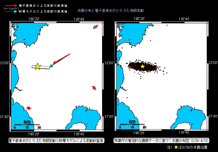

Red arrows in left figure show coseismic deformation which are observed by GPS-based Control Stations installed by GSI. Blue arrows in left figure show the deformation estimated by the fault model estimated by the data of the crustal deformation measured by SAR and GPS. The star shows the epicenter of the main shock, the rectangle shows the estimated location of the fault. The dotted line of the rectangle shows the deep side (14km depth), the opposite real line shows the shallow side (4km depth).
Right figure shows the aftershock distribution provided by the Japan Meteorological Agency(JMA). The estimated location of the fault closely overlaps with the aftershock distribution provided by JMA.