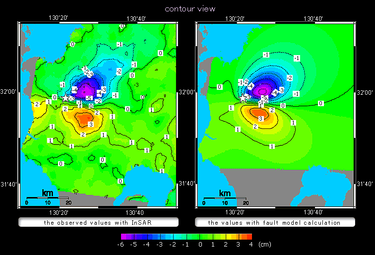
Contour map showing the change in distance (cm) between the satellite and the surface.
Negative values show movements away from the satellite (subsidence or westward displacement) and positive values show movements toward the satellite (uplift or eastward displacement).

Contour map showing the change in distance (cm) between the satellite and the surface.
Negative values show movements away from the satellite (subsidence or westward displacement) and positive values show movements toward the satellite (uplift or eastward displacement).