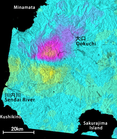
Northwest Kagoshima Prefecture Earthquake
March 26, 1997 M6.3
The crustal deformation on the north of the fault (near the center of the image, in the east-west direction) moved to the different direction compared with the south side.
How to understand the SAR interferogram

The crustal deformation on the north of the fault (near the center of the image, in the east-west direction) moved to the different direction compared with the south side.