Details of deformation sensing
Using data acquired from the Japanese SAR satellite JERS-1 ("FUYO-1"), which NASDA (JAXA today) launched in 1992, GSI has detected various deformations such as earthquake, volcanic activity and subsidence across the globe.
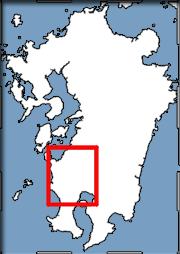
For the Northwest Kagoshima Prefecture Earthquake (M6.3) that occurred on March 26, 1997, we detected the deformations of about 6cm and 3cm which are distributed in pattern like two eyespots by analyzing the SAR data of JERS-1 provided by NASDA. Then through these deformations we calculated the movement of an invisible underground fault that generated the earthquake, and revealed that the fault, which was 12 kilometers long, 11 kilometers wide and 4 to 14 kilometers below ground, slipped 50 centimeters.
So without survey equipments on the ground, the crustal movement observation by InSAR can detect the 2-dimensional movements for an area tens of kilometers square and the movements of underground faults in detail.
Using this technique, we detected the crustal deformation of a few tens of centimeters caused by the 1995 South Hyogo Prefecture Earthquake. This time, we succeed in providing details of crustal deformation with a precision of a few centimeters by using together a more improved analysis technique and the crustal deformation data measured by GPS-based Control Stations (GPS continuous observation points).
