Haiti Earthquake(2010/1/12,M7.0)
How to understand the SAR interferogram
| No. | Interferogram | Specifications | Comments | Down load |
|
|---|---|---|---|---|---|
| 1 |
|
Observation date | 2010/01/13 2010/02/28 |
A pair shortly after the earthquake. There is no deformation which is distinguishable from noise.
*Accuracy of the used orbit data:High precision orbit data. |
|
| Observation Mode | FBS/HH FBS/HH |
||||
| Orbital direction | Descending | ||||
| Off-nadir [degree] |
25.8 | ||||
| Baseline[m] (Bperp) |
+94 | ||||
| Range (lat/lon) |
18.17/19.61/ -72.68/-71.72 |
||||
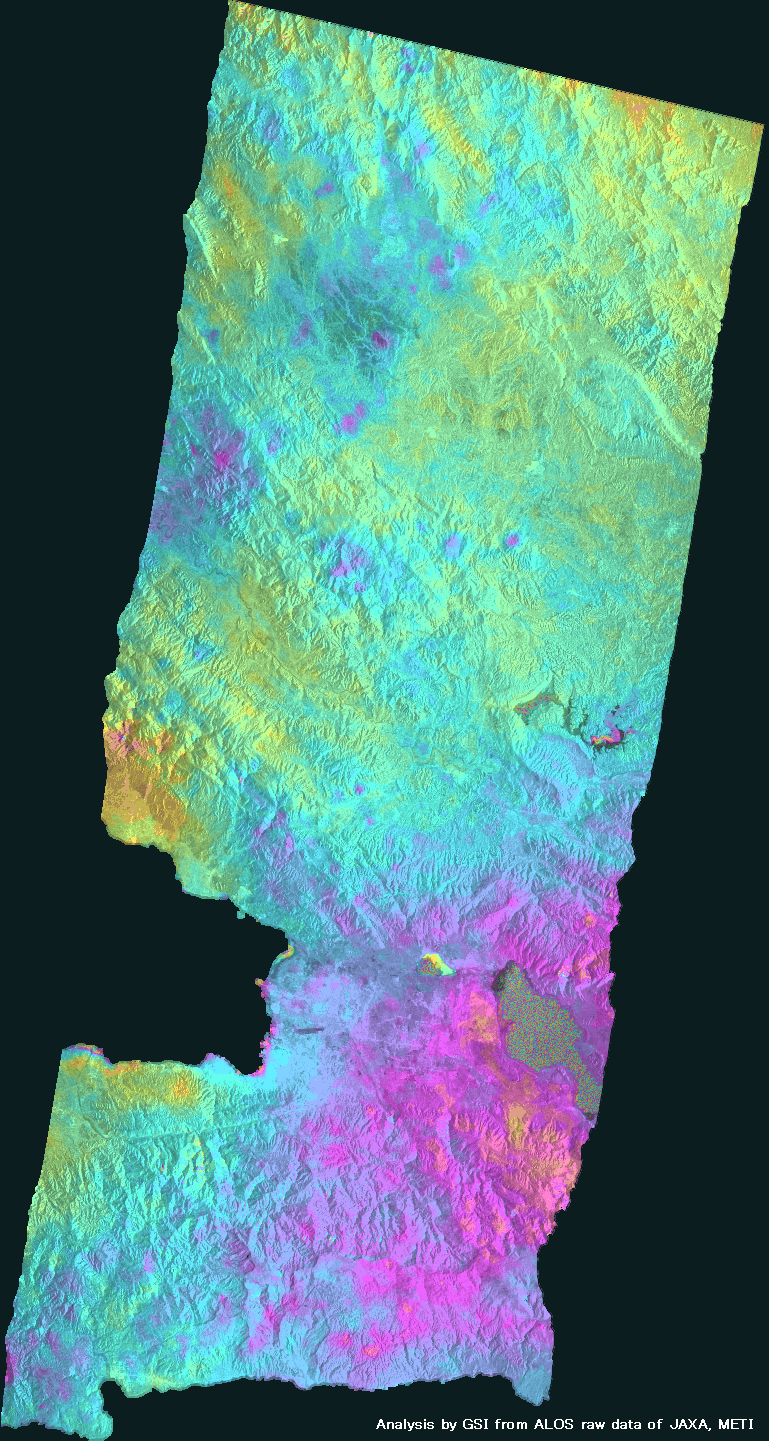
| 2 |

|
Observation date | 2008/02/09 2010/02/14 |
The obvious crustal deformation caused by the earthquake appears. In particular, in the northern coast of the south side land, the large crustal deformation appears. The Line-of-sight (LOS) displacement toward the satellite amounts to about 70 cm.
*Accuracy of the used orbit data:High precision orbit data. |
|
| Observation Mode | FBS/HH FBS/HH |
||||
| Orbital direction | Ascending | ||||
| Off-nadir [degree] |
34.3 | ||||
| Baseline[m] (Bperp) |
-426 | ||||
| Range (lat/lon) |
18.14/19.40/ -72.95/-72.14 |
||||
| 3 |
|
Observation date | 2009/09/12 2010/01/28 |
There is the phase change around the bay (left of center in this image) which may be caused by the earthquake, although it's in the same range of noise.
*Accuracy of the used orbit data:High precision orbit data. |
|
| Observation Mode | FBD/HH FBS/HH |
||||
| Orbital direction | Ascending | ||||
| Off-nadir [degree] |
34.3 | ||||
| Baseline[m] (Bperp) |
+807 | ||||
| Range (lat/lon) |
18.20/19.39/ -72.5/-71.64 |
||||
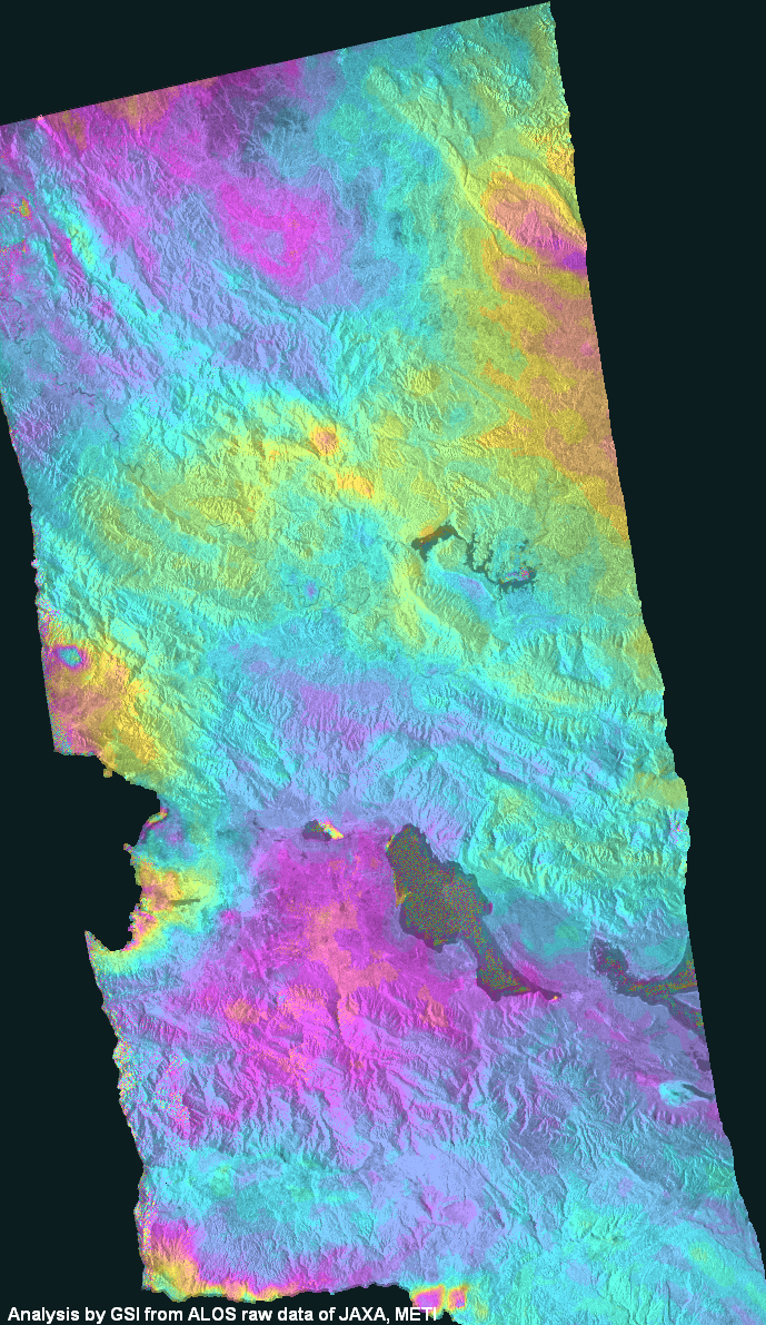
| 4 |

|
Observation date | 2009/03/09 2010/01/25 |
The obvious crustal deformation caused by the earthquake appears.
*Accuracy of the used orbit data:High precision orbit data. |
|
| Observation Mode | FBS/HH FBS/HH |
||||
| Orbital direction | Descending | ||||
| Off-nadir [degree] |
34.3 | ||||
| Baseline[m] (Bperp) |
+806 | ||||
| Range (lat/lon) |
18.14/19.37/ -73.06/-72.07 |
||||
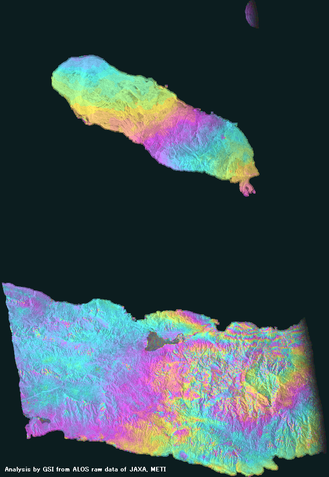
| 5 |
|
Observation date | 2009/02/28 2010/01/16 |
The crustal deformation caused by the earthquake appears in the eastern part of the south side land.
*Accuracy of the used orbit data:High precision orbit data. |
|
| Observation Mode | FBS/HH FBS/HH |
||||
| Orbital direction | Ascending | ||||
| Off-nadir [degree] |
34.3 | ||||
| Baseline[m] (Bperp) |
+1,048 | ||||
| Range (lat/lon) |
18.14/19.08/ -73.43/-72.62 |
||||
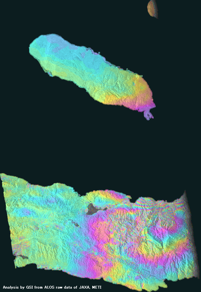
| 6 |
|
Observation date | 2007/10/11 2010/01/16 |
The crustal deformation caused by the earthquake appears in the eastern part of the south side land.
*Accuracy of the used orbit data:High precision orbit data. |
|
| Observation Mode | FBD/HH FBS/HH |
||||
| Orbital direction | Ascending | ||||
| Off-nadir [degree] |
34.3 | ||||
| Baseline[m] (Bperp) |
-266 | ||||
| Range (lat/lon) |
18.14/19.08/ -73.42/-72.61 |
||||