South Sumatra Earthquake (2009/10/1,M6.6)
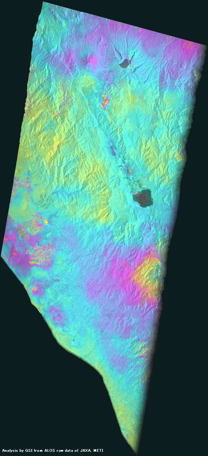
How to understand the SAR interferogram
| No. | Interferogram | Specifications | Comments | Down load |
|
|---|---|---|---|---|---|
| 1 |
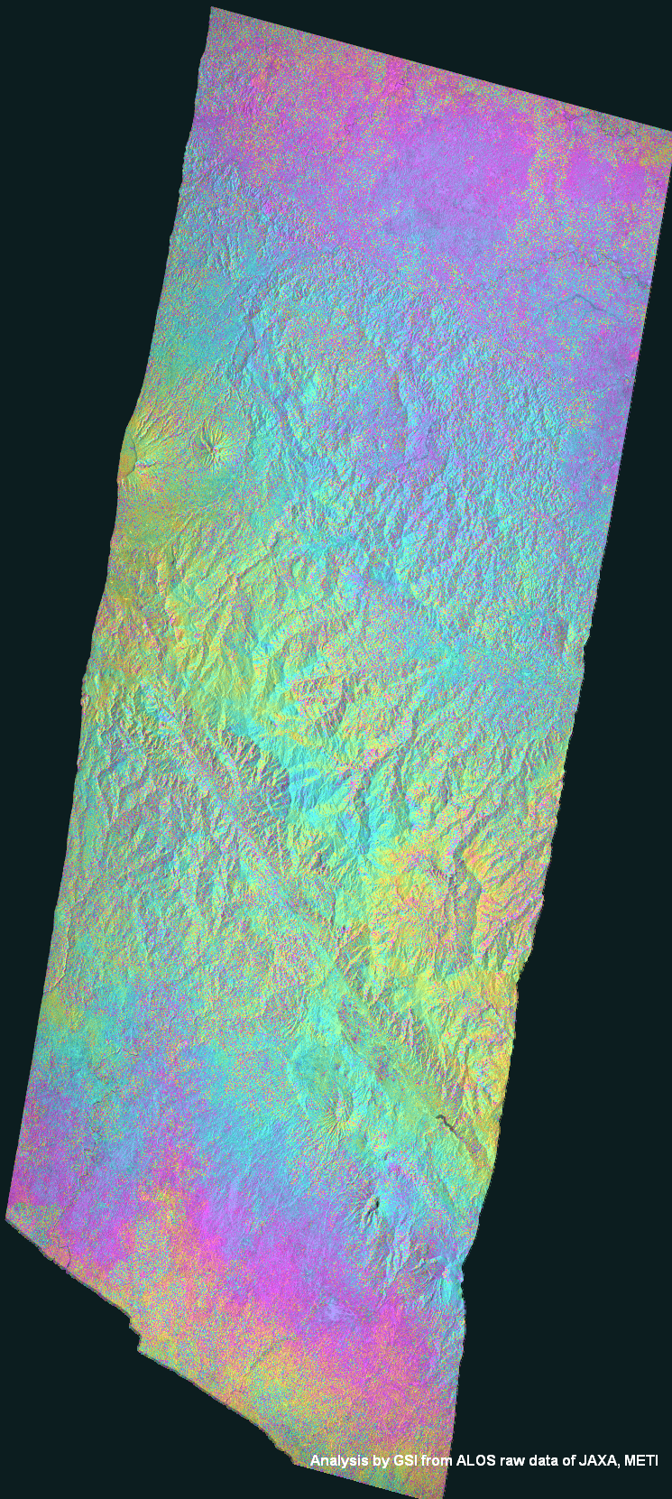
|
Observation date | 2008/11/17 2009/10/05 |
There is no deformation which is distinguishable from noise.
*Accuracy of the used orbit data:High precision orbit data. |
|
| Observation Mode | FBS/HH FBS/HH |
||||
| Orbital direction | Descending | ||||
| Off-nadir [degree] |
34.3 | ||||
| Baseline[m] (Bperp) |
-133 | ||||
| Range (lat/lon) |
-3.64/-1.98/ 101.73/102.66 |
||||
| 2 |
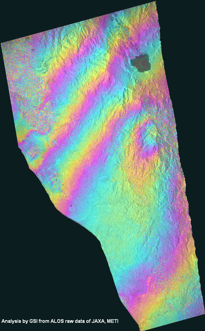
|
Observation date | 2008/10/05 2009/10/08 |
There is the phase disturbance caused by the noise, but the crustal deformation caused by the earthquake appears in the center of image.
*Accuracy of the used orbit data:High precision orbit data. |
|
| Observation Mode | FBD/HH FBD/HH |
||||
| Orbital direction | Ascending | ||||
| Off-nadir [degree] |
34.3 | ||||
| Baseline[m] (Bperp) |
-22 | ||||
| Range (lat/lon) |
-3.033/-1.939/ 100.9075/101.7525 |
||||
| 3 |
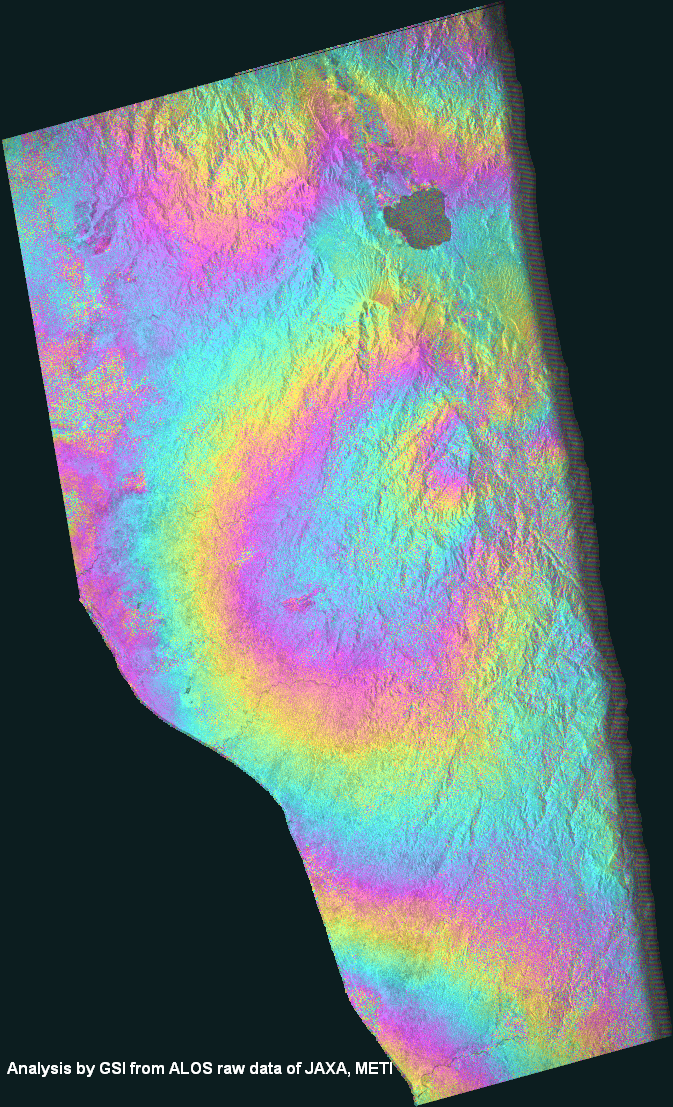
|
Observation date | 2009/02/20 2009/10/08 |
There is the phase disturbance caused by the noise, but the crustal deformation caused by the earthquake appears in the center of image. *Accuracy of the used orbit data:High precision orbit data. |
|
| Observation Mode | FBS/HH FBD/HH |
||||
| Orbital direction | Ascending | ||||
| Off-nadir [degree] |
34.3 | ||||
| Baseline[m] (Bperp) |
+74 | ||||
| Range (lat/lon) |
-3.035/-1.929/ 100.96625/101.80625 |
||||
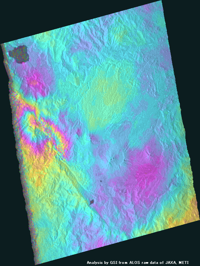
| 4 |

|
Observation date | 2009/01/19 2009/10/22 |
The crustal deformation caused by the earthquake appears.
*Accuracy of the used orbit data:High precision orbit data. |
|
| Observation Mode | FBS/HH FBS/HH |
||||
| Orbital direction | Descending | ||||
| Off-nadir [degree] |
34.3 | ||||
| Baseline[m] (Bperp) |
-177 | ||||
| Range (lat/lon) |
-3.452/-1.481/ 101.3/102.30125 |
||||
| 5 |
|
Observation date | 2009/09/21 2009/11/06 |
The crustal deformation caused by the earthquake appears.
*Accuracy of the used orbit data:High precision orbit data. |
|
| Observation Mode | FBD/HH FBS/HH |
||||
| Orbital direction | Ascending | ||||
| Off-nadir [degree] |
34.3 | ||||
| Baseline[m] (Bperp) |
+198 | ||||
| Range (lat/lon) |
-2.84/-1.97/ 101.41/102.23 |
||||
| 6 |
|
Observation date | 2008/11/05 2009/11/08 |
The crustal deformation caused by the earthquake appears.
*Accuracy of the used orbit data:High precision orbit data. |
|
| Observation Mode | FBS/HH FBS/HH |
||||
| Orbital direction | Descending | ||||
| Off-nadir [degree] |
34.3 | ||||
| Baseline[m] (Bperp) |
-232 | ||||
| Range (lat/lon) |
-3.0/-1.491/ 100.8975/101.75625 |
||||