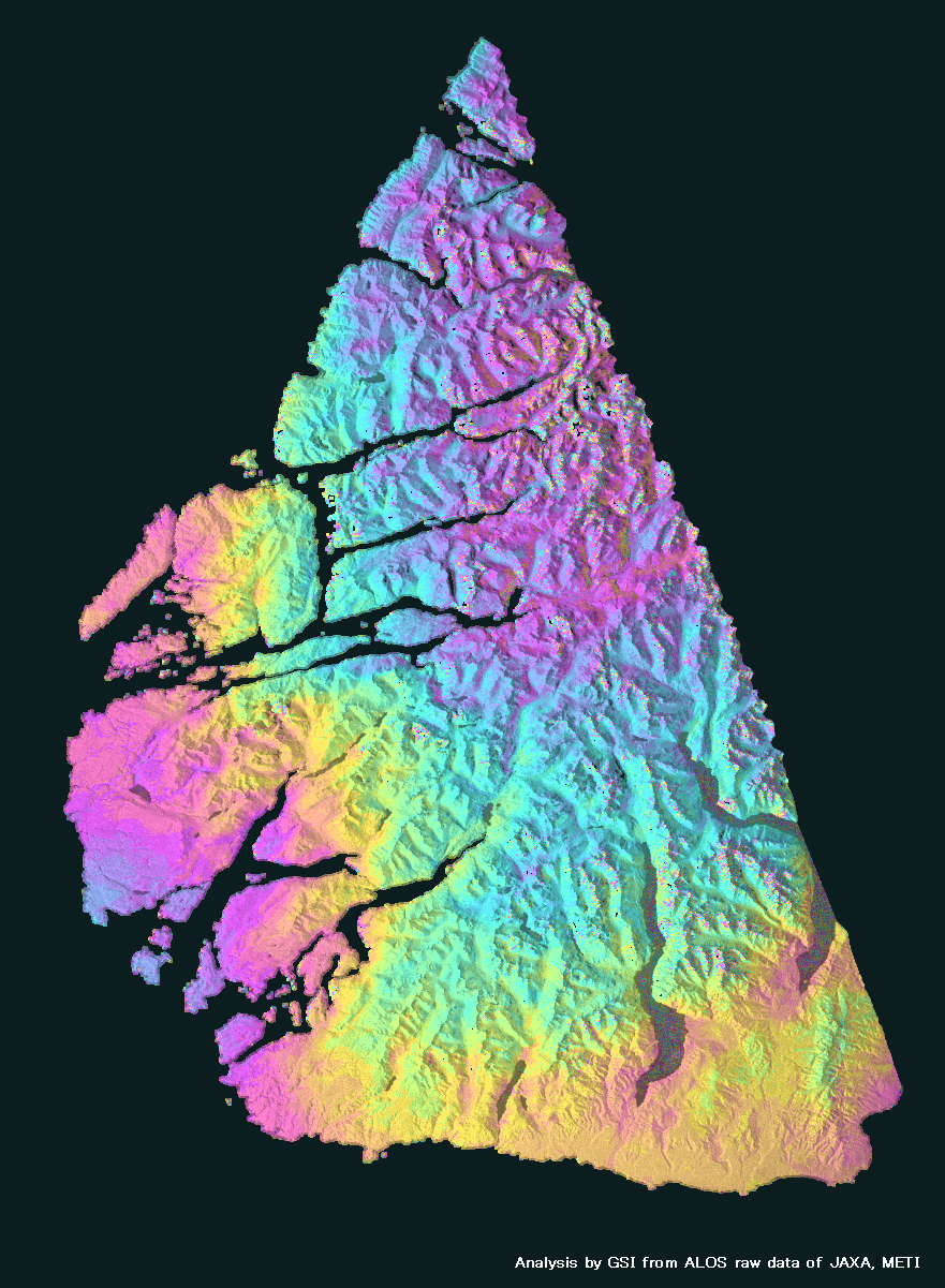
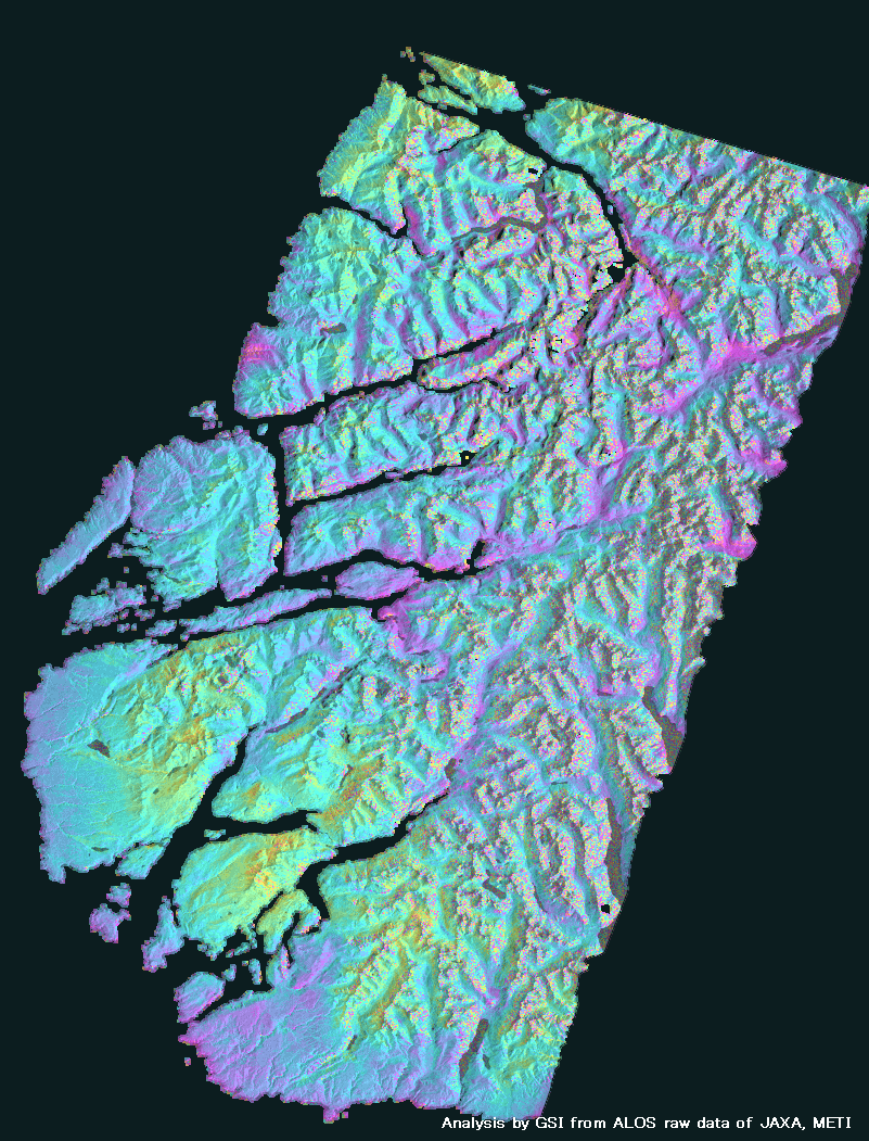
South New Zealand Earthquake (2009/7/15,M7.6)
How to understand the SAR interferogram
| No. | Interferogram | Specifications | Comments | Down load |
|
|---|---|---|---|---|---|
| 1 |
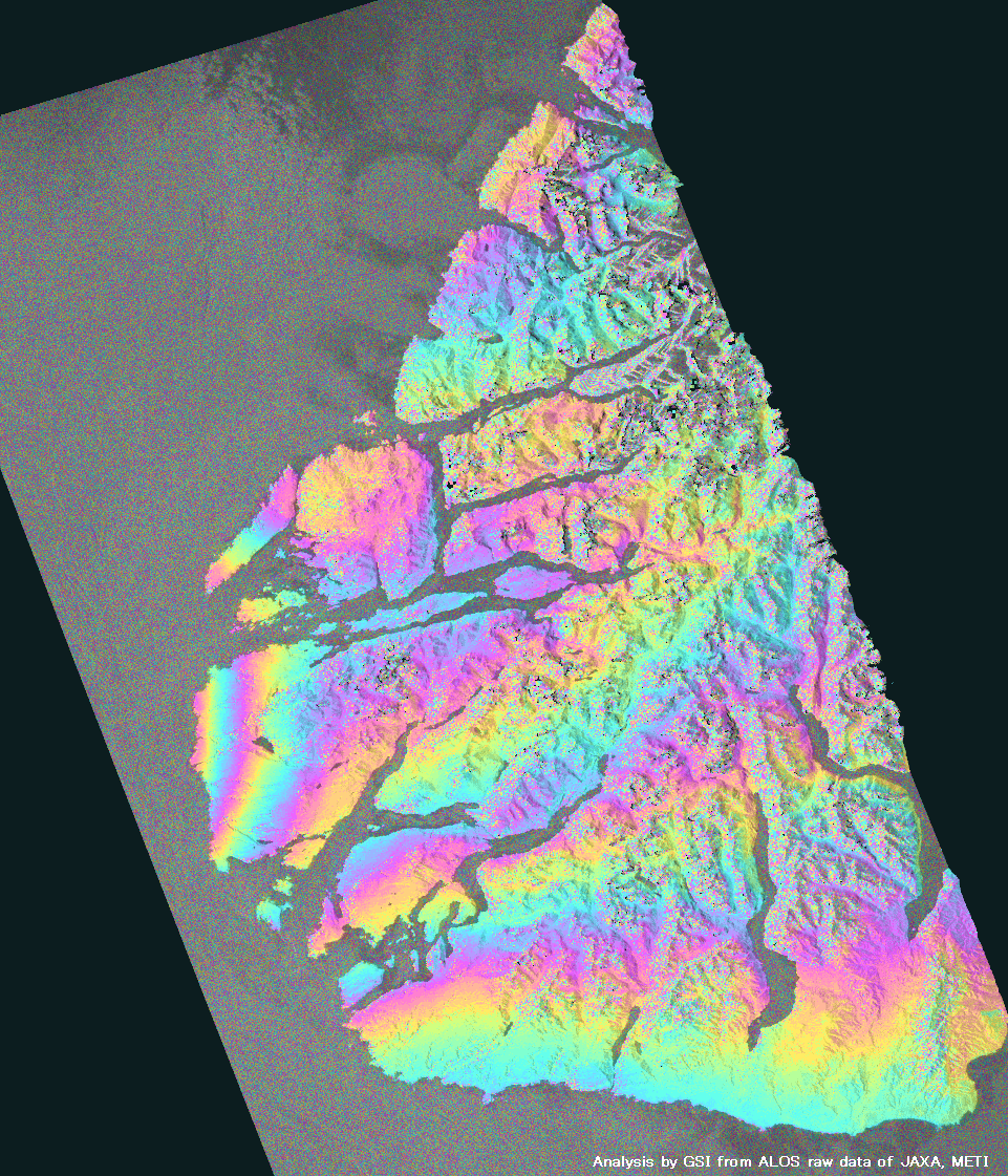
|
Observation date | 2009/01/12 2009/07/15 |
The obvious crustal deformation caused by the earthquake appears on the west coast of New Zealand's South Island.
*Accuracy of the used orbit data:High precision orbit data(2009.07.22 update). |
|
| Observation Mode | FBS/HH FBD/HH |
||||
| Orbital direction | Ascending | ||||
| Off-nadir [degree] |
34.3 | ||||
| Baseline[m] (Bperp) |
-1,131 | ||||
| Range (lat/lon) |
-46.30/-45.18/ 166.20/167.40 |
||||
| 2 |
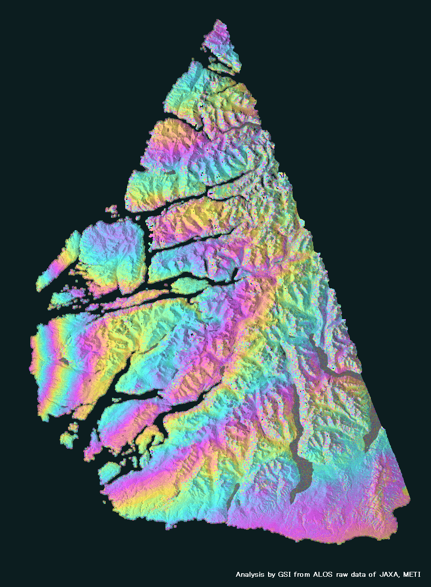
|
Observation date | 2007/02/22 2009/07/15 |
The obvious crustal deformation caused by the earthquake appears.
*Accuracy of the used orbit data:High precision orbit data. |
|
| Observation Mode | FBS/HH FBD/HH |
||||
| Orbital direction | Ascending | ||||
| Off-nadir [degree] |
34.3 | ||||
| Baseline[m] (Bperp) |
+834 | ||||
| Range (lat/lon) |
-46.35/-45.15/ 166.35/167.45 |
||||
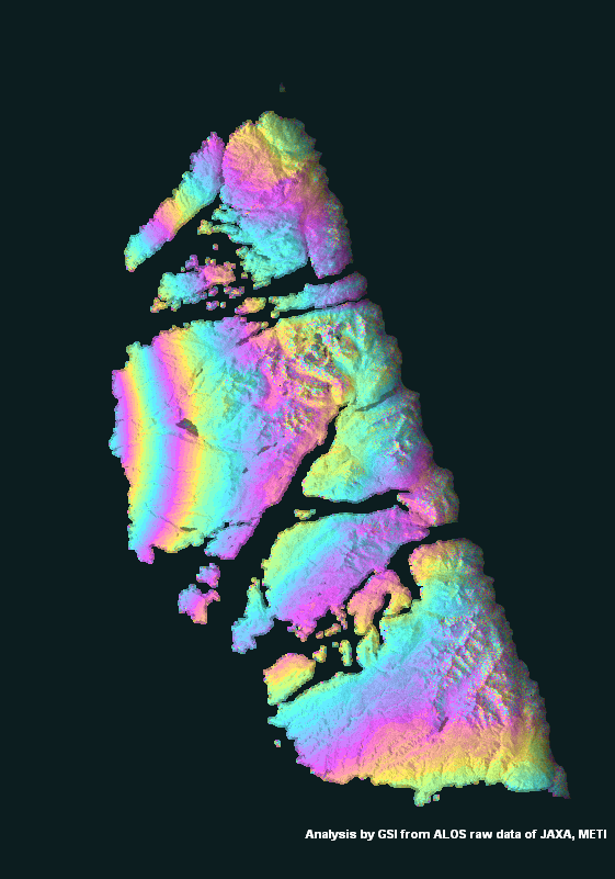
| 3 |

|
Observation date | 2008/07/20 2009/07/23 |
The obvious crustal deformation caused by the earthquake appears.
*Accuracy of the used orbit data:High precision orbit data. |
|
| Observation Mode | FBS/HH FBS/HH |
||||
| Orbital direction | Descending | ||||
| Off-nadir [degree] |
34.3 | ||||
| Baseline[m] (Bperp) |
+423 | ||||
| Range (lat/lon) |
-46.25/-45.20/ 166.40/167.40 |
||||
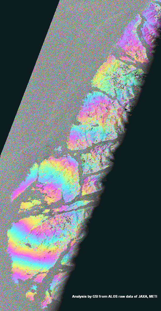
| 4 |
|
Observation date | 2009/06/16 2009/08/01 |
The obvious crustal deformation caused by the earthquake appears.
*Accuracy of the used orbit data:High precision orbit data. |
|
| Observation Mode | FBD/HH FBD/HH |
||||
| Orbital direction | Ascending | ||||
| Off-nadir [degree] |
34.3 | ||||
| Baseline[m] (Bperp) |
-346 | ||||
| Range (lat/lon) |
-46.30/-45.50/ 166.30/167.00 |
||||
| 5 |
|
Observation date | 2008/06/21 2009/08/09 |
The obvious crustal deformation caused by the earthquake appears.
*Accuracy of the used orbit data:High precision orbit data. |
|
| Observation Mode | FBS/HH FBS/HH |
||||
| Orbital direction | Descending | ||||
| Off-nadir [degree] |
34.3 | ||||
| Baseline[m] (Bperp) |
+932 | ||||
| Range (lat/lon) |
-46.10/-45.10/ 166.40/167.05 |
||||
| 6 |

|
Observation date | 2009/06/28 2009/08/13 |
The obvious crustal deformation caused by the earthquake appears.
*Accuracy of the used orbit data:High precision orbit data. |
|
| Observation Mode | FBD/HH FBD/HH |
||||
| Orbital direction | Ascending | ||||
| Off-nadir [degree] |
34.3 | ||||
| Baseline[m] (Bperp) |
-394 | ||||
| Range (lat/lon) |
-46.40/-44.86/ 166.62/168.03 |
||||
| 7 |
|
Observation date | 2009/07/15 2009/08/30 |
Postseismic deformation appears.
*Accuracy of the used orbit data:High precision orbit data. |
|
| Observation Mode | FBD/HH FBD/HH |
||||
| Orbital direction | Ascending | ||||
| Off-nadir [degree] |
34.3 | ||||
| Baseline[m] (Bperp) |
-222 | ||||
| Range (lat/lon) |
-46.35/-45.15/ 166.35/167.45 |
||||
| 8 |
|
Observation date | 2009/07/23 2009/09/07 |
No deformation.
*Accuracy of the used orbit data:High precision orbit data. |
|
| Observation Mode | FBS/HH FBS/HH |
||||
| Orbital direction | Descending | ||||
| Off-nadir [degree] |
34.3 | ||||
| Baseline[m] (Bperp) |
-576 | ||||
| Range (lat/lon) |
-46.25/-45.20/ 166.40/167.40 |
||||