South Hyogo Prefecture Earthquake
January 17, 1995 M7.3
Crustal deformation caused by the South Hyogo Prefecture Earthquake. There is a large deformation from Awaji Island to Kobe. In Mount Rokko, the high-lying area has large uplift.
How to understand the SAR interferogram
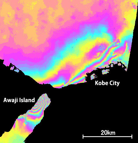

Crustal deformation caused by the South Hyogo Prefecture Earthquake. There is a large deformation from Awaji Island to Kobe. In Mount Rokko, the high-lying area has large uplift.